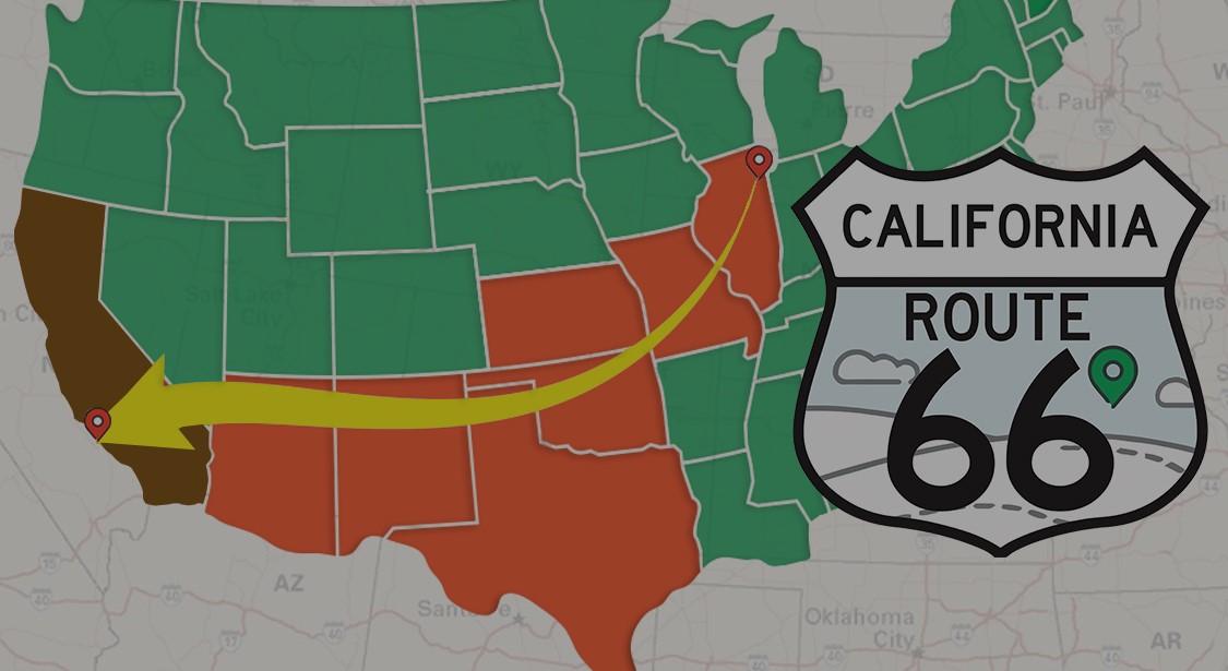
This Adventure Lab is part of the Historic Route 66 series that runs from Chicago to Santa Monica.
WARNING: This Adventure currently includes many road sections that are closed to motor traffic. You may be issued a moving violation if you go past the road closed signs. Your only "legal" access to some of these stages will be to walk to them, but I did provide very generous Geofencing. Please enter the desert prepared and understand the great risks involved in entering the desert by any means of transportation or walking.
This Adventure is currently approximately 60 miles along the legal routes from Goffs to Amboy. You can legally visit the towns of Essex and Chambless, but will need to backtrack along your route. Expect this Adventure to take 1-2 hours until you get lost in the history of Goffs!
Sorry there is no bonus cache for this Adventure. There are plenty of caches in the area to find!
Use your phone's native QR code scanner to open this Adventure in the Adventure Lab® mobile app.

Until further notice, there are numerous closed sections along this portion of Route 66. These are motorized road closures and going around the road closed signs can result in you being cited with a costly moving violation. You can complete this Advenute without violating any laws. For more information, please visit the page below.
You can also find the most current road conditions on the San Bernardino County Road Closures Page.
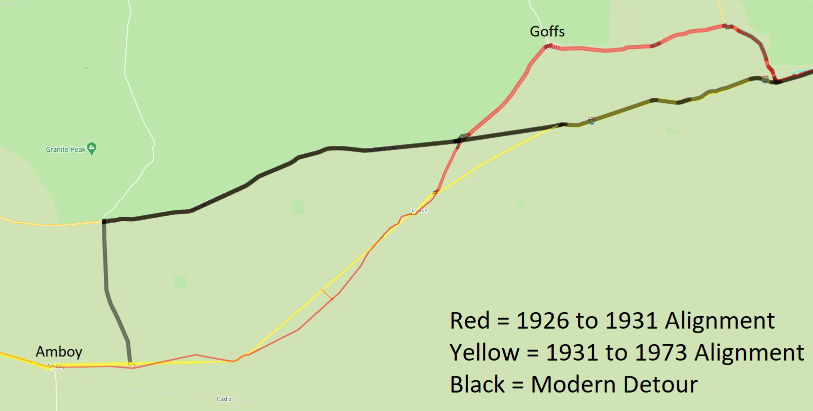
This section of Route 66 has two different alignments. The 1926 to 1931 alignment went north from Needles roughly along the present day US 95 and then west at Arrowhead Junction to Goffs. From Goffs it went through the town of Fenner and into Essex. From 1931 to 1973 Goffs and Fenner were bypassed from US 95 outside of Needles through Mountain Springs Summit and straight to Essex.
You can find an interactive map with satellite imagery at the bottom of the www.route66ca.org maps page.
The Adventure has your basic information for these locations. However, some of them have so much additional information and research, we have inlcuded that material here! If you notice any broken links, please contact me and let me know!
Here are some links for your reading pleasure: Camp Goffs - Wikipedia, Historic California Posts: Camp Goffs, & Goffs - Desert Training Center Sky Trail.
The best way to learn about the Goffs Schoolhouse is to catch the location open and go inside! However, here are some more links for you as well. Mojave Desert Heritage and Cultural Association - Goff's Schoolhouse Museum on Historic Route 66 - California - Goffs School House - On old Rt 66 - DesertUSA - Goffs, Route 66 California - Route 66 Travel Guide
If you are traveling eastbound on I-40 there is a Camp Clipper plaque located at the rest stop 1.5 miles west of Exit 107 Goffs Road Essex. Otherwise here are your links! Fenner, Route 66 California - Route 66 Travel Guide - Camp Clipper Wikipedia
Wayside Cafe links: Essex, Route 66 California - Route 66 Travel Guide - Route 66 Mother Road Postcards and more on Facebook
Essex Water Well links: Essex, Route 66 California - Route 66 Travel Guide
Consider taking a detour here and exploring the old townsite of Danby which was close to being on the 1926 to 1931 Alignment. You can find it by looking for the traditional cache The House at Danby. Danby links: Danby, Route 66 California - Route 66 Travel Guide
This is also a good opportunity to learn how to access historic topographical maps online. The USGS Topo View provides maps of this area starting in 1943 all the way though 2018. Just click on the map to place a dot then you will see a list of maps on the right side of your screen (desktop viewing is best). You will note that the dates on the 1943 maps might not be accurate because they clearly show the 1926-1931 Alignment. The 1950s maps will show the post 1931 Alignment. Note the scales listed and the detail difference between them. If you go to the modern satellite view of this area, you can clearly see the current and past alignments and that they did not go through the actual town of Danby. I have found these old topographical maps very useful while searching out benchmarks and you might too!
Have you ever used Waymarking to look up a Virtual Geocache answer? No? Why not? Well you are welcome for learning that pro-tip! Mojave Desert "Route 66" Roadside Exhibit
Here are a lot of nice links for the Cadiz Summit location: Cadiz Summit, Cal - Route 66 — Cali49 - Route 66, Cadiz Summit - Digital-Desert - Cadiz Summit, Yesterday and Today - DesertUSA Stories
Chambless Links: Chambless, Route 66 California - Route 66 Travel Guide - Chambless Market, Station, & Cottages Route 66 Times - Off the Map: Ghost Towns of the Mother Road – Chambless
Road Runner's Retreat links: The Roadrunner's Retreat near Chambless, California - Road Runner's Retreat on Facebook
Powered by w3.css